Îles de la Madeleine cruise port guide
Cruise calls to the Îles de la Madeleine normally mean Cap-aux-Meules, the central port of this Gulf of St Lawrence archipelago.
Your arrival at a glance
- Arrival
Ships either dock or anchor and tender you ashore. About tendering
- Getting into town
Cap-aux-Meules cruise reception area to the Sentier du littoral entrance, after the berth exit or tender transfer.
- Walking
You can walk into town. About the walk. If you tender, the walk starts at the landing.
- Getting back
Canada · Canada & New England · Small ships
Checked by Najapi on · Source policy · Suggest a correction
Arrival & Getting Ashore
Getting to the centre: Cap-aux-Meules cruise reception area to the Sentier du littoral entrance, after the berth exit or tender transfer.
- Walk: a realistic local outing; the official cruise brochure places the coastal path within walking distance of the cruise terminal. Its 2 km length describes the path itself, not the approach from your berth.
Orientation, not a walking route
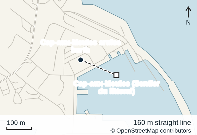
© OpenStreetMap contributors · Open in OpenStreetMap
The commercial berths are the port’s main cruise entry point; ships with greater draught anchor outside the port and bring passengers to floating pontoons. The port profile describes alongside arrivals, while Seabourn explicitly lists Cap-aux-Meules as a tender port. Follow your ship's instructions through the working port to reception rather than using the vehicle lanes serving other harbour traffic.
The Cruise Pavilion provides tourist information, toilets and free Wi-Fi. Water “shuttles” in the port description are tenders between anchored ships and shore; they are not buses around town. If anchored, establish the return-boat location before leaving the reception area.
About this port
Cruise calls to the Îles de la Madeleine normally mean Cap-aux-Meules, the central port of this Gulf of St Lawrence archipelago. This guide covers that arrival, rather than treating every island as a separate terminal. The islands are also known in English as the Magdalen Islands.
A short call can work as a waterfront walk at Cap-aux-Meules. With more time and arranged transport, choose either the southern heritage area around Havre-Aubert or the landscapes and food producers of Havre-aux-Maisons. Trying to cover the whole archipelago can leave little time outside a vehicle.
Getting Around
Walking is useful near Cap-aux-Meules, but the other village choices need transport. The destination's port map estimates 25 km and 30 minutes by road to Havre-Aubert, or 7 km and 10 minutes to Havre-aux-Maisons. These are broad village transfer estimates; a particular museum, beach or workshop adds its own travelling and visiting time.
A booked shore tour is a straightforward way to combine scattered sights. If arranging a private vehicle, settle the return pickup at the same time as the outward trip and give the driver your cruise reception point.
For onward travel beyond the reception-to-coastal-path walk, RÉGÎM operates public transport that needs advance planning. The route 54 midday service introduced in September 2026 connects Cap-aux-Meules, the secondary school and Gros-Cap. It requires a reservation for midday journeys, with requests accepted until 16:00 the previous day (checked 2026-10-02). This is a local service with specific stops, not a turn-up-and-go island sightseeing bus or a guaranteed terminal transfer.
Things to Do
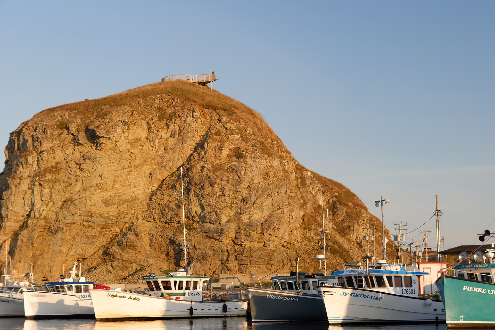
Stay near the port: follow the Sentier du littoral for sea views and a walk whose length you can adjust. The separate climb at its entrance reaches a viewpoint by 187 steps. Skip that staircase if it does not suit your mobility; walking the coastal path and climbing the lookout are different activities.
Havre-Aubert and La Grave: the historic waterfront district offers shops, galleries and places to eat. Make this the main destination of a southern outing, with time to browse rather than treating the drive as the excursion. The tourism board's walking map identifies La Grave, museums and local products in this village.
Havre-aux-Maisons: choose this direction for rural scenery and craft or food stops. The destination organisation lists Le Fumoir d'Antan, devoted to smoked herring, and La Méduse glassworks. Build the route around the businesses actually open during your call; their listing does not mean demonstrations run continuously.
Getting back to your ship
Return to the cruise reception area, following your ship's directions within Cap-aux-Meules port. For a tender call, plan around the final tender and its queue. A road excursion has to finish before that boat deadline, not simply before sailing time. Avoid an ambitious last stop at the far end of an island route when your driver still needs to get you back to the port.
Practical Information
The islands' dunes and red cliffs are fragile. Use established beach access and stay back from cliff edges rather than following a photograph's apparent viewpoint. Wind is part of the local environment, so carry a secure outer layer and protect loose belongings on exposed walks.
Cap-aux-Meules has everyday services including food shops and pharmacies, according to the tourism board's village map. Keep basic supplies with you on a longer island outing. For mobility needs, discuss the exact berth or tender transfer with the ship; a port-wide accessibility promise would conceal important differences.
Sources
Sites consulted: transportmaritime.info, cruisecanadanewengland.com, tourismeilesdelamadeleine.com, seabourn.com, vikingcruises.com, regim.info. Details can change after a guide is checked, so confirm time-sensitive points with the operator. How we check our guides.
Printed from https://portatlas.co.uk/north-america/canada/iles-de-la-madeleine/. Guide check date appears above; consult the sources for time-sensitive details.