Magdalenefjorden, Svalbard cruise port guide
Magdalenefjorden is a remote fjord in north-western Spitsbergen, within Nordvest-Spitsbergen National Park.
Your arrival at a glance
- Arrival
Ships anchor offshore and tender you ashore. About tendering
- Getting into town
Gravneset's eastern sandy beach is the usual expedition landing; there is no settlement or town-centre transfer.
- Walking
Step-free details. The walk starts at the tender landing.
- Getting back
Norway · Norwegian Fjords & Arctic Norway · Small ships
Checked by Najapi on · Source policy · Suggest a correction
Arrival & Getting Ashore
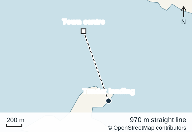
Getting to the centre: Gravneset's eastern sandy beach is the usual expedition landing; there is no settlement or town-centre transfer.
- Step-free: no; passengers transfer by small boat onto a sandy beach.
Sources: Norwegian Polar Institute, Governor of Svalbard landing map.
Orientation, not a walking route
© OpenStreetMap contributors · Open in OpenStreetMap
Where a landing is permitted and conditions allow, expedition passengers transfer from their vessel in small boats to the shore. Gravneset is identified in the Governor's official mapping of designated tourist landing areas. The Norwegian Polar Institute's cruise handbook describes its beach landings. This is a beach landing rather than an alongside cruise terminal, and it provides no onward link to a settlement.
The expedition team decides whether a landing can proceed after assessing weather, sea conditions, wildlife and the site's requirements. Be prepared for the plan to change even after arrival in the fjord. Remain available for the landing briefing and follow instructions about clothing, lifejackets, footwear and boarding the boats.
About this port
Magdalenefjorden is a remote fjord in north-western Spitsbergen, within Nordvest-Spitsbergen National Park. It is an expedition destination shaped by mountains, glaciers and early whaling history. There is no town itinerary to follow: a visit depends on the expedition vessel, the permitted landing area and conditions on the day.
The protected setting is central to planning. Current rules cap the number of passengers aboard ships entering the park's marine area at 200, checked on 8 September 2026. A larger ship cannot overcome that limit simply by sending a smaller party ashore. The operator's programme states whether the itinerary includes a landing.
Getting Around
Movement ashore is on foot under the expedition team's supervision. Stay inside the permitted area and follow the route indicated by the guides. There is no independent bus, taxi or road option for continuing a visit elsewhere; the ship and its boats provide both access and the return journey.
Discuss mobility needs before the call. Stepping between vessel and small boat, and then onto an uneven shore, can be more demanding than the length of the subsequent walk suggests. A short landing is not automatically an accessible one. Viewing from the vessel remains a worthwhile part of the experience if disembarkation is unsuitable.
Things to Do
Read the whaling landscape at Gravneset. The Governor's heritage record identifies a whaling station and burial ground dating to the early whaling period, including remains of blubber ovens. These small traces give human scale to the surrounding mountains. Listen to the guide's interpretation and observe barriers; weathered remains can be fragile and difficult to distinguish from ordinary stones.
Observe the fjord from the ship. Mountain profiles, glaciated slopes and changing light reward patient looking. Bring binoculars if you have them, and choose a sheltered viewing position when necessary. The visit need not depend on a particular animal appearing or a glacier calving. Those are natural events that an itinerary cannot promise.
Take part in a managed shore walk. If the team opens the landing, use the opportunity to understand the relationship between the coast, vegetation and historic remains. Walk where directed and leave everything in place. Do not cross a barrier for a photograph, collect souvenirs from the ground or separate from the group to look for wildlife.
Getting back to your ship
Movement ashore is on foot under the expedition team's supervision. Stay inside the permitted area and follow the route indicated by the guides. There is no independent bus, taxi or road option for continuing a visit elsewhere; the ship and its boats provide both access and the return journey.
Practical Information
Prepare on board: bring the clothing, drinking water and equipment specified by the expedition team. Use toilets and obtain supplies on board before the landing. Norwegian kroner (NOK) are Svalbard's currency, but money has no practical use during the shore walk. Norwegian is the local administrative language; the ship determines the languages used during its landings.
Recreational drones are prohibited in this protected area. Polar-bear precautions and remote communications must remain with the qualified expedition team. Alert a guide immediately if help is needed; do not rely on ordinary mobile reception. Norway's emergency numbers are 110 for fire, 112 for police and 113 for an ambulance. Svalbard is on UNESCO's Tentative List, not its inscribed World Heritage List.
Frequently asked
Do cruise passengers tender ashore in Magdalenefjorden? Yes. Expedition passengers use small boats to reach the sandy beach at Gravneset when the landing opens.
Is the Gravneset landing step-free? No. It is a small-boat transfer onto a sandy beach rather than a level cruise terminal.
Can you take a taxi or bus from Gravneset? No. Gravneset has no road or settlement; movement ashore is on foot with the expedition team.
Is there a town centre in Magdalenefjorden? No. This is a remote expedition site in Nordvest-Spitsbergen National Park, not a port town.
Sources
Sites consulted: cruise-handbook.npolar.no, sysselmesteren.no, prod.sysselmesteren.no, en.visitsvalbard.com, whc.unesco.org, visitnorway.com. Details can change after a guide is checked, so confirm time-sensitive points with the operator. How we check our guides.
Printed from https://portatlas.co.uk/europe/norway/magdalenenfjord/. Guide check date appears above; consult the sources for time-sensitive details.