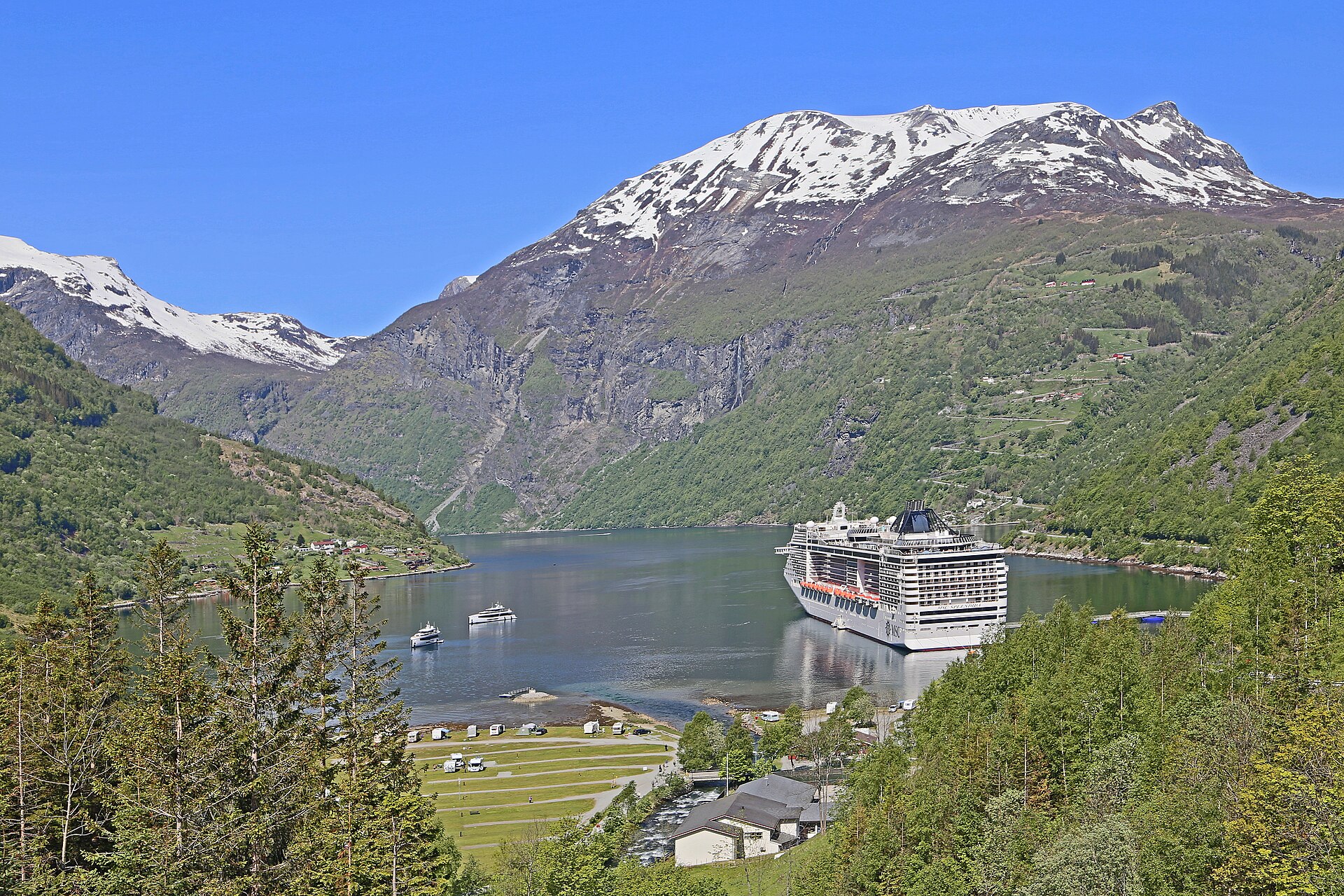
Norwegian Fjords & Arctic Norway
Plan coastal and fjord calls with the landing arrangements and onward journey in mind.
58 guides in Norwegian Fjords & Arctic Norway
No guides match these filters in Norwegian Fjords & Arctic Norway. Clear filters.
Getting into town
A walkable port isn't necessarily step-free. At tender ports, the walk starts at the landing. A fare may cover only part of the journey, so check the guide for the full route.
↔ Full table: scroll for all columns. Names and headings stay visible. Focus the table area and use arrow keys.
| Port | Destination | Walking assessment | Time / distance | Arrival | Shuttle / public transport |
|---|---|---|---|---|---|
| Åkrafjord Scenic CruisingNorway | Not applicable: this guide covers a route or several places. | Not applicable (route overview) | Walk: Not applicable Distance: Not applicable | Route overview | Not applicable (route overview) |
| ÅlesundNorway | from the southern cruise berths at Storneskaia, Stornespiren and Prestebrygga, head into town towards Brosundet and Jugendstilsenteret. | Conditional within 20 minutes one way to Brosundet or Jugendstilsenteret, according to regional tourism guidance; realistic on foot, with hilly and partly cobbled streets. | Walk: 20 min Distance: Not recorded | Dock | Shuttle: none Public transport: not recorded |
| AltaNorway | figures are from Alta Harbour at Terminalkaia to Alta city centre, with the Northern Lights Cathedral as the central landmark. | Conditional possible but long rather than a quick port walk, especially in winter weather. | Walk: Not recorded Distance: 5.0 km | Dock or tender · walking starts after landing | Shuttle: not recorded Snelandia bus 42 · 57 NOK one-way Prices checked |
| ÅndalsnesNorway | figures are from Tindekaia to Åndalsnes town centre at the railway station and Norwegian Mountaineering Centre. | Realistic realistic along the central waterfront; the port places the centre 200 metres from the quay. | Walk: Not recorded Distance: 0.2 km | Dock | Not needed: you can walk |
| ArendalNorway | figures are from Batterikaien to the central waterfront around Pollen and Tyholmen. | Realistic about 5 minutes; realistic on the mostly paved, flat central waterfront. | Walk: 5 min Distance: 0.2 km | Dock | Not needed: you can walk |
| BalestrandNorway | the route is from Balestrand tenderkai to the Norwegian Museum of Travel and Tourism in the village centre. | Realistic realistic; the museum describes itself as centrally located by the pier. | Walk: Not recorded Distance: Not recorded | Tender · walking starts after landing | Not needed: you can walk |
| BekkjarvikNorway | the usable published route is from Leirvikjo harbour to Bekkjarvik Torg; the standard cruise landing is not identified by the available port or cruise-line sources. | Not recorded realistic; the harbour operator calls the route to Bekkjarvik Torg longer than from its other harbour areas, but not discouraging. | Walk: Not recorded Distance: Not recorded | Dock or tender · walking starts after landing | Shuttle: not recorded Public transport: not recorded |
| Bergen (Fjord Norway)Norway | these figures cover Skolten and Bontelabo to the Fish Market at Torget, beside the Zachariasbryggen excursion-boat quay. | Realistic about 10–15 minutes from Skolten to Zachariasbryggen beside the Fish Market; realistic along the waterfront past Bryggen, using the signed passenger exit from the port. | Walk: 15 min Distance: 0.9 km | Dock | Not needed: you can walk |
| BessakerNorway | these figures run from the ship at Fosen Kysthavn on Løaholmen to the centre of Bessaker, where Hurtigruten's forest excursion begins. | Realistic realistic on the well-lit pedestrian and cycle path linking the harbour directly with the centre. | Walk: Not recorded Distance: 1.5 km | Dock | Not needed: you can walk |
| Bjørnøya (Bear Island)Norway | Bjørnøya has no passenger terminal or town centre; any authorised transfer runs from the ship by expedition boat to the shore site selected for that landing. | Not recorded not realistic as an independent journey; all movement ashore is a guided expedition operation. | Walk: Not recorded Distance: Not recorded | Tender · walking starts after landing | Shuttle: not recorded Public transport: not recorded |
| BodøNorway | the port's range covers Torgkaien, Terminalkai Sør and Terminalkaien to central Bodø around the Visit Bodø office at Dronningens gate 15. | Realistic realistic; Hurtigruten describes an easy walk from its Terminalveien berth, while Torgkaien is on the central waterfront. | Walk: Not recorded Distance: approximately 0.2–1.2 km to the centre, depending on the assigned quay. | Dock | Not needed: you can walk |
| BrønnøysundNorway | these figures use the outer cruise berth at Gårdsøya/Nordhavna and the central harbour at Midthavna, around the port office at Havnegata 42, as the landmark. | Conditional partly realistic because of the 3 km length; ships at Midthavna are less than a five-minute walk from the centre. | Walk: See walking conditions Distance: 3.0 km | Dock | Shuttle: not recorded Public transport: not recorded |
| EidfjordNorway | the route runs from Eidfjord Cruise Port to the Ravenheart Viking Exhibition beside the tourist office in the village centre. | Realistic about 5 minutes; realistic through the compact centre from the quay. | Walk: 5 min Distance: Not recorded | Dock | Not needed: you can walk |
| EidsdalNorway | figures are from the Viking tender pier to Eidsdal village centre at the ferry terminal. | Realistic about 1 minute; realistic around the compact waterfront. | Walk: 1 min Distance: 0.1 km | Tender · walking starts after landing | Not needed: you can walk |
| Flåm, AurlandsfjordNorway | figures are from Flåm Cruise Pier to Flåm station and the adjoining visitor centre. | Realistic about 2 minutes; realistic across the compact, flat waterfront. | Walk: 2 min Distance: 0.2 km | Dock | Not needed: you can walk |
| Frøya IslandNorway | figures are from Sistranda quay to Frøya Kulturhus, which houses the tourist information point. | Realistic realistic; the port's 2026 guide explicitly describes the Kulturhus as walking distance from Sistranda quay. | Walk: Not recorded Distance: 0.8 km | Dock | Not needed: you can walk |
| Geiranger, GeirangerfjordNorway | from Geiranger cruise terminal's tender landing to the village waterfront centre, around the Visit Geiranger ticket office. | Realistic about 5 minutes; realistic for a waterfront visit, before the steep inland routes begin. | Walk: 5 min Distance: 0.1 km | Dock or tender · walking starts after landing | Not needed: you can walk |
| Gudvangen, NærøyfjordNorway | figures are from the Gudvangen tender quay in the village centre to Viking Valley Njardarheimr. | Realistic about 5 minutes; realistic through the compact village. | Walk: 5 min Distance: 0.3 km | Tender · walking starts after landing | Not needed: you can walk |
| HammerfestNorway | Hammerfest uses central quays and Fuglenes Kai 9; the Museum of Reconstruction at Kirkegata 19 is the central reference landmark. | Not recorded realistic from the central quays; Fuglenes is the longer harbour-side approach. | Walk: Not recorded Distance: Not recorded | Dock | Shuttle: not recorded Public transport: not recorded |
| HarstadNorway | figures are from Larsneset to Visit Harstad at Sjøgata 3 on the central waterfront. | Realistic a few minutes; realistic on the central waterfront. | Walk: See walking conditions Distance: 0.1 km | Dock | Not needed: you can walk |
| HaugesundNorway | figures are from Garpaskjærkaien to Haugesund town centre, reached across Risøy bridge. | Conditional about 20 minutes; realistic, but the bridge is steep for some wheelchair users and passengers with limited mobility. | Walk: 20 min Distance: 1.0 km | Dock | Ship-only shuttle · unknown fare Public transport: not recorded |
| Hellesylt, SunnylvsfjordNorway | figures are from Hellesylt Cruise Pier to the village centre and Hellesyltfossen. | Realistic a few minutes; realistic from the concrete pier through the security exit into the compact village. | Walk: See walking conditions Distance: 0.2 km | Dock or tender · walking starts after landing | Not needed: you can walk |
| Honningsvåg and the North CapeNorway | the cruise quays and tender landing are in central Honningsvåg, with Visit Nordkapp at Fiskeriveien 4D beside the harbour as the reference landmark. | Realistic a short walk; realistic over the compact town centre's mostly level terrain. | Walk: Not recorded Distance: Not recorded | Dock or tender · walking starts after landing | Not needed: you can walk |
| KirkenesNorway | figures are from Dypvannskaia cruise pier to Kirkenes town centre. | Not recorded Route conditions: not recorded. | Walk: Not recorded Distance: 1.3 km | Dock | Shuttle: not recorded Public transport: not recorded |
| KristiansandNorway | from Quay 10 at Lagmannsholmen, head towards Fiskebrygga and the central streets around Markens gate; the sightseeing train's town stop is Markensgate/Rådhusgata. | Realistic realistic for reaching Fiskebrygga and the centre; the cruise network describes walking access, and its town walking tour uses flat surfaces with some cobbles. | Walk: Not recorded Distance: Not recorded | Dock | Not needed: you can walk |
| KristiansundNorway | Storkaia and Devoldholmen are the two cruise quays, and the port's passenger manual measures both as already in Kristiansund town centre. | Not recorded Route conditions: not recorded. | Walk: Not recorded Distance: 0 km; both cruise quays are in Kristiansund town centre. | Dock | Shuttle: none Public transport: not recorded |
| LærdalNorway | Øyraplassen 14 is the central landmark for Lærdal tourist information and the Wild Salmon Visitor Centre. | Not recorded Route conditions: not recorded. | Walk: Not recorded Distance: Not recorded | Dock or tender · walking starts after landing | Shuttle: not recorded Public transport: not recorded |
| Lakselv and HamnbuktNorway | figures are from the Hamnbukt SeaWalk or tender-transfer point to Lakselv town centre. | Impractical not realistic for a port call; the centre is 9.4 km away. | Walk: Not recorded Distance: 9.4 km | Dock or tender · walking starts after landing | Shuttle: none Public transport: not recorded |
| Leirvik, StordNorway | figures are from the central Leirvik harbour quays to Stord kulturhus at Hamnegata 1, the town's tourist-information point. | Realistic realistic through the central harbour; the municipality places shops, restaurants and museums within walking distance. | Walk: Not recorded Distance: Not recorded | Dock or tender · walking starts after landing | Not needed: you can walk |
| Leknes and Gravdal, LofotenNorway | figures are from Leknes cruise quay or tender landing to Leknes sentrum around Storgata. | Conditional about 52 minutes; possible but long for a short call. | Walk: 52 min Distance: 4.0 km | Dock or tender · walking starts after landing | Ship-only shuttle · unknown fare Reis Nordland bus 742 · 45 NOK one-way Prices checked |
| Longyearbyen, SvalbardNorway | figures are from Bykaia cruise quay to Svalbard Museum in Forskningsparken, on the town-centre side of Longyearbyen. | Conditional about 20–25 minutes; realistic along the main road, though the route is not designed for large cruise crowds. | Walk: 25 min Distance: 1.9 km | Dock | Ship-only shuttle · unknown fare Public transport: not recorded |
| LysebotnNorway | figures are from Lysebotn ferry quay to Lysefjorden Turisthytte, a central village base beside the water. | Realistic about 2 minutes; realistic on the short village approach from the quay. | Walk: 2 min Distance: Not recorded | Dock or tender · walking starts after landing | Not needed: you can walk |
| Lysefjord Scenic CruisingNorway | Not applicable: this guide covers a route or several places. | Not applicable (route overview) | Walk: Not applicable Distance: Not applicable | Route overview | Not applicable (route overview) |
| Magdalenefjorden, SvalbardNorway | Gravneset's eastern sandy beach is the usual expedition landing; there is no settlement or town-centre transfer. | Not recorded Route conditions: not recorded. | Walk: Not recorded Distance: Not recorded | Tender · walking starts after landing | Shuttle: not recorded Public transport: not recorded |
| MåløyNorway | figures are from the ICT cruise berth to central Måløy; ships assigned to Trollebø use a road transfer instead. | Realistic about 5 minutes; realistic on the short, flat route from ICT. | Walk: 5 min Distance: Not recorded | Dock | Not needed: you can walk |
| MandalNorway | Mandal cruise ships anchor in the roadstead and tender passengers ashore for the compact town, with Mandal Museum as the central landmark. | Not recorded Route conditions: not recorded. | Walk: Not recorded Distance: Not recorded | Tender · walking starts after landing | Shuttle: not recorded Public transport: not recorded |
| MoldeNorway | the baseline is Storkaia to Molde town centre; Moldegård is the alternative cruise quay. | Not recorded Route conditions: not recorded. | Walk: Not recorded Distance: 0.1 km | Dock | Shuttle: not recorded Public transport: not recorded |
| NamsosNorway | distances are from Kiskaia or Spillum to central Namsos; the bus figure is from Namsen legesenter in the Spillum area to Namsos skysstasjon. | Not recorded Route conditions: not recorded. | Walk: Not recorded Distance: 0.8 km | Dock | Shuttle: not recorded AtB bus 783 · 50 NOK one-way Prices checked |
| NarvikNorway | figures are from central Pier 3 to Narvik town centre; Fagernes is a separate terminal. | Realistic Route conditions: not recorded. | Walk: Not recorded Distance: 0.5 km | Dock | Not needed: you can walk |
| Nordfjordeid, NordfjordNorway | the walking figure is from the SeaWalk landing to Sagastad, the central Viking-ship museum. | Realistic about 10 minutes; realistic through the compact, walkable town. | Walk: 10 min Distance: Not recorded | Dock or tender · walking starts after landing | Not needed: you can walk |
| Olden, NordfjordNorway | from Olden cruise quay to Olden village. Tender landings at Olden Cruise Park or Loen start elsewhere. | Not recorded a practical option for a village visit from the cruise quay. | Walk: Not recorded Distance: 0.7 km | Dock or tender · walking starts after landing | Shuttle: not recorded Public transport: not recorded |
| OsloNorway | from Revierkaia's landside Skur 44 building, use Oslo Central Station (Oslo S/Jernbanetorget) as your central landmark. | Realistic about 10 minutes from Skur 44 to Oslo S; realistic via the harbour promenade and city streets, after leaving the secure quay. | Walk: 10 min Distance: Not recorded | Dock | Not needed: you can walk |
| Reine, LofotenNorway | figures are from Reine Hurtigbåtkai to Reine village centre. | Realistic about 10 minutes; realistic as a leisurely village walk. | Walk: 10 min Distance: Not recorded | Dock | Not needed: you can walk |
| RørvikNorway | figures are from Hurtigruten's D/S Kaien to the Norveg coastal-culture centre on the central waterfront. | Realistic about 2 minutes; realistic on foot across the compact waterfront. | Walk: 2 min Distance: Not recorded | Dock | Not needed: you can walk |
| Rosendal, HardangerfjordNorway | figures are from Rosendal's tender landing to the Folgefonn Centre at the harbour. | Realistic realistic on foot around the compact harbour. | Walk: Not recorded Distance: 0.1 km | Tender · walking starts after landing | Not needed: you can walk |
| SandnesNorway | from Somaneset cruise quay, the walking destination is Rådhuskaien beside Sandnes's town hall; the bus serves Ruten bus station in the centre. | Realistic about 20–25 minutes to Rådhuskaien; realistic along the town approach past the harbour to the town hall, using the permitted port exit. | Walk: 25 min Distance: Not recorded | Dock | Not needed: you can walk |
| SandnessjøenNorway | figures are from Horvnes Quay 3 to Kulturbadet and the bus terminal in central Sandnessjøen. | Impractical not realistic from this heavy-industrial quay. | Walk: Not recorded Distance: 3.5 km | Dock | Shuttle: service unknown Public transport: not recorded |
| SkjoldenNorway | figures are from Skjolden Cruise Pier to Fjordstova in the village centre. | Realistic about 30 minutes; realistic on the port's walking-itinerary route. | Walk: 30 min Distance: 1.3 km | Dock | Not needed: you can walk |
| SortlandNorway | Terminalkaia is the central passenger quay; the figures and directions here use the shopping streets around Sortland Museum at Rådhusgata 11 as the centre landmark. | Not recorded realistic after following the designated passenger exit from the working quay; Terminalkaia and the museum are both in central Sortland. | Walk: Not recorded Distance: Not recorded | Dock | Shuttle: not recorded Public transport: not recorded |
| StavangerNorway | Strandkaien is the main cruise quay beside Vågen, with Fisketorget (the fish market) as a central waterfront landmark; the walking range covers the city's central cruise quays. | Realistic about 5–10 minutes into the centre, depending on the quay; realistic on the harbour-front route, with cobbled lanes when you turn into Gamle Stavanger. | Walk: 10 min Distance: Not recorded | Dock | Not needed: you can walk |
| SvolværNorway | figures are from Osan, the designated cruise quay, to central Svolvær around Torget; Hurtigrutekaia is closer. | Realistic realistic into compact central Svolvær; follow the signed passenger route from the working quay. | Walk: Not recorded Distance: 1.0 km | Dock | Not needed: you can walk |
| TrænaNorway | Hurtigruten's Svalbard Line docks on Husøya, and the village around Træna Church and the museum is the centre landmark used here. | Not recorded an easy, realistic stroll from Hurtigruten's quay into the village; the operator's cultural excursion continues on foot around Husøya. | Walk: Not recorded Distance: Not recorded | Dock | Shuttle: not recorded Public transport: not recorded |
| TromsøNorway | from Breivika cruise terminal, take the city-bound bus to Torgsenteret; the port's pedestrian route continues to the tourist information at Prostneset. | Conditional realistic for passengers comfortable with a longer harbour-road walk; use the underpass, walking path and bridge crossings along Stakkevollvegen. | Walk: Not recorded Distance: Not recorded | Dock | Ship-only shuttle · unknown fare Svipper bus 42 · 30-50 NOK one-way Prices checked |
| TrondheimNorway | these directions start at Cruise Quay 68 on Brattøra and use Nidaros Cathedral as the central landmark. | Realistic realistic for passengers comfortable walking into town and back; leave by the marked port exit and continue through the central streets. | Walk: Not recorded Distance: 2.0 km | Dock | Not needed: you can walk |
| UlvikNorway | figures are from the tender landing beside Brakanes Hotel to Ulvik village centre. | Realistic realistic through the compact waterfront village; the port material describes easy strolls in and around the centre. | Walk: Not recorded Distance: 0.2 km | Tender · walking starts after landing | Not needed: you can walk |
| VardøNorway | Vardø city harbour's steamship quay and the harbour-side streets around Vardøhus Fortress are the arrival point and centre landmark used here. | Not recorded realistic for a city-harbour arrival on town streets; the route is exposed to Barents Sea wind. | Walk: Not recorded Distance: Not recorded | Dock | Shuttle: not recorded Public transport: not recorded |
| Vik, SognefjordNorway | figures are from the Kristianhus cruise tender landing to Vik village centre. | Realistic realistic; Cruise Norway describes the village's attractions, shops and cafés as within walking distance of the port. | Walk: Not recorded Distance: 0.2 km | Tender · walking starts after landing | Not needed: you can walk |
| VikøyriNorway | figures are from the Kristianhus cruise tender landing to the centre of Vikøyri. | Realistic realistic; Cruise Norway describes the village's attractions, shops and cafés as within walking distance of the port. | Walk: Not recorded Distance: 0.2 km | Tender · walking starts after landing | Not needed: you can walk |
How to read these comparisons
We only compare shuttles and public transport where walking isn't a clear yes. A bus or shuttle may cover only part of the way, or go somewhere else entirely, so check the guide for the route and what the ticket covers. Free shuttles come first. Fares are only put in order when the tickets are the same kind.
Not recorded: we haven't checked this yet, though the guide may say more. None: the guide records no such service. Not applicable: the comparison doesn't fit, either because the guide covers a route or several places, or because you can walk and a shuttle doesn't matter. Unknown fare: there's a service, but we don't have its price. Service unknown: we haven't confirmed the shuttle runs.
Times and distances run from the berth or landing to the landmark named in each guide. That isn't always the city on your itinerary. On the walking page, realistic walks come first, then conditional ones, then ports where walking isn't practical. Within each group, the shortest walks come first.